

Upgrading a 15-Year-Old Chartplotter: What You Need to Know

Table of Contents
- Signs It's Time to Upgrade Your Chartplotter
- Marine Electronics Compatibility: What Actually Works Together
- Cost of Upgrading Marine Navigation Electronics
- New Features Worth the Investment
- DIY vs. Professional Installation Checklist
- Resale Value and Power Consumption Considerations
- Conclusion
Last Updated: August 29, 2026
Signs It's Time to Upgrade Your Chartplotter
A 15-year-old chartplotter still works, but working and optimal are different things. The core question isn't whether your current system functions, it's whether it's holding you back from safer, more efficient navigation.
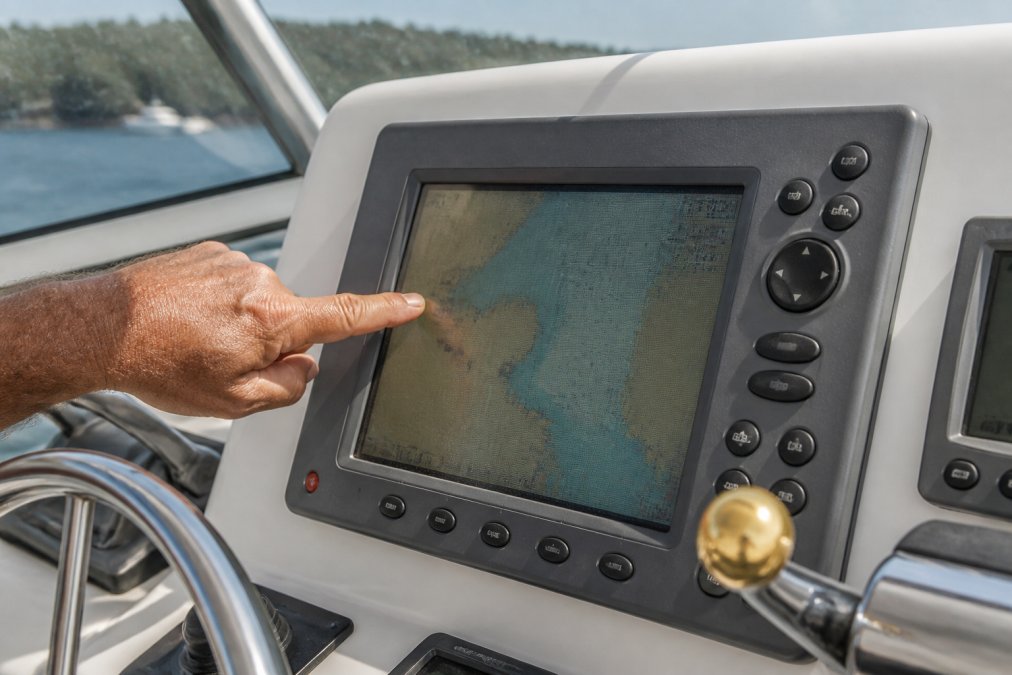
Display degradation is the most obvious indicator: faded pixels, slower refresh rates, and reduced brightness in daylight compromise your ability to read critical navigation data. Processing speed matters more than boat owners realize, older chartplotters lag when loading detailed charts or integrating multiple data sources. Modern systems respond instantly, which becomes critical during docking or responding to weather changes.
Chart compatibility creates a hidden safety problem. Cartography updates continuously, and older systems eventually stop receiving the latest navigational data. Your charts become outdated relative to current bathymetry and hazard markers. Integration challenges compound over time: if new equipment won't communicate with your old chartplotter, you're managing multiple data streams manually instead of consolidating everything into one interface.
Power consumption also shifts your calculus. Older electronics draw more current from your vessel's electrical system, which matters on extended cruises. Newer chartplotters are engineered for efficiency, reducing drain on your batteries and alternator. Warranty and support disappear for electronics older than 10-15 years, parts become scarce, repair costs climb, and manufacturers stop releasing firmware updates (garmin.com).
Marine Electronics Compatibility: What Actually Works Together
The biggest mistake boat owners make when upgrading is assuming any new chartplotter will talk to their existing sensors and instruments. Compatibility isn't automatic, your transducer, radar antenna, GPS receiver, and autopilot all need to speak the same language, defined by NMEA standards.
NMEA 0183 vs. NMEA 2000 Network Installation
NMEA 0183 is the older standard, still used on many vessels (nmea.org). It's a single-line, serial protocol where each device connects individually to the chartplotter via dedicated cables. NMEA 2000 is the modern standard, using a backbone network where devices tap in at junction points and communicate bidirectionally.
The practical difference: upgrading from NMEA 0183 to NMEA 2000 requires replacing not just the chartplotter, but the entire wiring harness and potentially your transducer and other sensors. Adapters exist but introduce latency and complexity. If you're upgrading the chartplotter, budget for upgrading the network backbone and compatible sensors simultaneously.
Integration with Legacy Hardware
Some existing equipment might be worth keeping. A quality transducer can last 20+ years if undamaged, but integration depends on whether it speaks the right protocol. Older Garmin transducers often use NMEA 0183, while newer systems expect NMEA 2000. If you're upgrading to a modern Garmin chartplotter like the Garmin GPSMAP 1243xsv Combo GPS/Fishfinder, you'll need NMEA 2000-compatible transducers.
![Garmin GPSMAP 1243xsv Combo GPS/Fishfinder GN+ [010-02367-61]](https://cdn.shopify.com/s/files/1/0842/4914/9751/files/97020XL.jpg?v=1775847911)
Autopilot systems present another compatibility layer. A new chartplotter can control an old autopilot, but you're mixing protocols. For seamless integration where all systems share data in real time, upgrading the autopilot alongside the chartplotter is often necessary. Radar systems are particularly tricky, the radome antenna lasts decades, but the electronics age faster. Most modern systems use NMEA 2000, so compatibility is usually achievable, but verification is essential before buying.
Cost of Upgrading Marine Navigation Electronics
The total cost spans hardware, installation labor, and sometimes unexpected integration work.
Display and Processor Costs
The chartplotter itself is the primary expense. Screen size drives price significantly. Charleston Yachting carries the full range of modern Garmin systems. The Garmin GPSMAP 743xsv Combo GPS/Fishfinder starts at $1,299.99 for a 7-inch combo unit. The Garmin GPSMAP 1243xsv steps up to $3,099.99 for a 12-inch display with higher resolution. For larger vessels, the Garmin GPSMAP 1543xsv Ultrawide offers 74% more screen width at $4,499.99. At the high end, the Garmin GPSMAP 1643xsv delivers a 16-inch IPS display for $5,099.99.
![Garmin GPSMAP 743xsv Combo GPS/Fishfinder GN+ [010-02365-61]](https://cdn.shopify.com/s/files/1/0842/4914/9751/files/97012XL.jpg?v=1775847908)
![Garmin GPSMAP 1543xsv Ultrawide Combo GPS/Fishfinder GN+ [010-03855-01]](https://cdn.shopify.com/s/files/1/0842/4914/9751/files/109209XL.jpg?v=1775849830)
These combo units bundle GPS and fishfinder functionality. Transducers add $300-$800 depending on frequency and imaging capability. If you're upgrading from NMEA 0183, expect to replace the transducer entirely.
Installation and Labor Costs
Professional installation labor typically runs $1,500-$3,500, depending on your vessel's complexity. Cost drivers include wiring harness installation (especially if upgrading to NMEA 2000), transducer installation requiring haul-out, integration testing, and antenna/cable runs.
DIY installation is possible if you're comfortable with electrical work and marine wiring standards. Many boat owners handle simpler upgrades without professional help. But integration testing and troubleshooting require expertise, and mistakes can damage expensive equipment.
New Features Worth the Investment
Modern chartplotters offer capabilities that fundamentally change how you navigate.
Side Imaging and Live Sonar
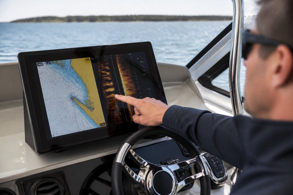
Side imaging sonar displays a photorealistic view of the bottom and structure to the sides of your vessel. Live sonar updates continuously as you move, showing real-time underwater conditions. For anchoring in unfamiliar locations, live sonar reveals actual bottom composition, mud, sand, or rock, which determines holding power. These features are standard on modern combo units like the Garmin GPSMAP 1243xsv and higher.
Modern Interface Speed and Touchscreen Response
Older chartplotters used button interfaces with menu hierarchies requiring multiple clicks. Modern systems use touchscreens with gesture controls: pinch to zoom, swipe to pan, tap to select waypoints. The responsiveness is immediate, with no lag between input and display update.
Processing speed also affects chart rendering. Modern processors load detailed cartography instantly, even at full zoom. Older systems stall when switching between chart scales. Weather overlay integration is another modern feature, current chartplotters overlay real-time weather data, radar imagery, and sea state forecasts directly on your chart, simplifying route planning and hazard avoidance.
DIY vs. Professional Installation Checklist
Deciding whether to install a new chartplotter yourself or hire a professional depends on your skills, vessel complexity, and risk tolerance.
DIY installation makes sense if:
- Your new chartplotter mounts in the exact location as the old one
- You're using the same transducer and NMEA protocol
- You have experience with marine electrical systems
- Your vessel's wiring is organized and accessible
- You have multimeter and marine-grade testing equipment
- You're comfortable troubleshooting if devices don't communicate
- Your vessel is simple: no autopilot, radar, or other integrated systems
Professional installation is necessary if:
- You're upgrading from NMEA 0183 to NMEA 2000
- The new chartplotter location differs from the old one
- You're adding new sensors: transducers, radar, AIS, or wind instruments
- Your vessel has an autopilot or other integrated systems
- You lack experience with marine electrical work
- Your vessel's wiring is crowded or inaccessible
- You want warranty coverage and professional liability insurance
A hybrid approach is common: DIY the physical removal and mounting, then hire a professional for wiring, integration testing, and system configuration.
Resale Value and Power Consumption Considerations
A 15-year-old Garmin chartplotter in working condition sells for 20-40% of its original price on used markets, offsetting some upgrade costs. However, condition matters enormously, a faded screen or corroded connectors drops resale value to near zero.
Power consumption directly affects your vessel's electrical budget. Older chartplotters draw 2-4 amps continuously, while modern systems typically consume 1-2 amps at normal brightness (peer-reviewed research). Over a day of navigation, this difference translates to meaningful battery savings. On vessels with limited electrical capacity, small sailboats, cruising catamarans with solar panels, or boats running on battery power, the power efficiency of a modern system justifies the upgrade on its own.
Modern IPS displays achieve brightness with less power than older LCD displays, which is why newer Garmin systems are both brighter and more efficient than their predecessors.
Upgrading a 15-year-old chartplotter isn't a simple hardware swap, it's a system decision that affects safety, efficiency, and how you interact with your vessel. The investment in a modern multi-function display, compatible sensors, and professional installation pays dividends in situational awareness, navigation speed, and reliability.
Charleston Yachting stocks the full range of modern Garmin navigation systems, from the compact GPSMAP 743xsv to the premium GPSMAP 1643xsv, all backed by same-day shipping and expert curation. Whether you're upgrading a single chartplotter or building a complete integrated system, our inventory includes the marine electronics and compatibility expertise to guide your decision.
Frequently Asked Questions
Why should I replace a 15-year-old chartplotter that still works?
A 15-year-old chartplotter often lacks modern cartography updates, GPS accuracy improvements, and safety features like AIS integration. Older systems also consume more power, have slower processors, and may not support current NMEA 2000 network standards. Additionally, replacement parts become harder to find, and the display often becomes harder to read in bright sunlight. Upgrading provides better navigation reliability, faster response times, and access to real-time weather overlay and autopilot integration that modern systems offer.
What's the difference between NMEA 2000 and NMEA 0183 for upgrading chartplotter systems?
NMEA 0183 is an older serial protocol that sends data one direction at a time and requires separate cables for each sensor. NMEA 2000 is a modern network backbone that allows all marine electronics to communicate simultaneously through a single data bus, reducing wiring complexity and enabling real-time data sharing. When upgrading your NMEA 2000 network installation, you'll gain faster data transfer, easier integration of new sensors, and the ability to add devices without rewiring. Conversion from legacy NMEA 0183 systems to NMEA 2000 requires a gateway device but provides significant reliability improvements.
How much does it cost to upgrade marine navigation electronics?
The cost of upgrading marine navigation electronics varies by display size and features. A 7-inch combo unit like the Garmin GPSMAP 743xsv starts at $1,299.99, while a 12-inch system runs $3,099.99, and a 16-inch display reaches $5,099.99. Budget an additional $200 to $800 for transducers, wiring harnesses, and network components. Total system replacement for a mid-sized vessel usually ranges from $2,500 to $7,000 including labor.
Can I keep my old transducer and sensors when upgrading my chartplotter?
It depends on your transducer's connector type and frequency. Most modern chartplotters support multiple transducer options through compatible interfaces. However, older radome antennas and depth sounders may not be compatible with new NMEA 2000 network standards. Before upgrading, verify your existing sensors' specifications and confirm compatibility with your new chartplotter's data bus. Many boat owners find that upgrading the entire system with new transducers ensures optimal performance and eliminates integration challenges with legacy hardware, though this increases overall cost.
This article was written using GrandRanker