

Garmin Marine Network Integration Tips

Table of Contents
- Understanding Garmin Marine Network Basics
- Garmin NMEA 2000 vs Marine Network: Which One Do You Need?
- Physical Cable Connection and Grounding Requirements
- Setting Up Your Device List and Network Discovery
- Sharing Sonar Data Between Garmin Displays
- Troubleshooting Garmin Marine Network Connectivity Issues
- Network Expansion and Cabling Best Practices
- Conclusion
Last Updated: August 21, 2026
Understanding Garmin Marine Network Basics
A Garmin marine network is an integrated system of connected devices, chartplotters, multifunction displays (MFDs), sensors, and transducers, that share navigation, sonar, and system data across a single backbone. This eliminates redundant sensors and allows every display to access real-time information simultaneously.
![Garmin 20' Marine Network Cable - RJ45 [010-10551-00]](https://cdn.shopify.com/s/files/1/0842/4914/9751/files/16791XL.jpg?v=1775841409)
The backbone is typically built using NMEA 2000 (a standardized marine protocol) or Garmin's proprietary BlueNet architecture. Both use drop cables and connectors to link devices in a daisy-chain or star topology. The key advantage is data sharing: once a transducer is connected, every chartplotter sees the sonar data without additional wiring.
Most recreational boats start with a single chartplotter and transducer. As you add electronics, a proper Garmin marine network becomes essential. Without it, you're running parallel systems that don't communicate, wasting money and creating maintenance headaches. With it, everything talks to everything else, and you get redundancy: if one display fails, the others still have access to all sensor data.
Garmin NMEA 2000 vs Marine Network: Which One Do You Need?
NMEA 2000 and Garmin's marine network serve the same fundamental purpose but operate differently.
NMEA 2000 is an open industry standard used across marine electronics from multiple manufacturers. It uses a backbone cable with drop cables connecting individual devices. Data flows across this bus at fixed bandwidth, and devices communicate using a standardized protocol. NMEA 2000 networks are highly interoperable, you can mix Garmin, Simrad (B&G), and other brands on the same backbone.
Garmin's marine network is designed specifically for Garmin devices and uses similar physical cabling but optimized for Garmin's ecosystem. It offers tighter integration between Garmin chartplotters, MFDs, and compatible sensors. The trade-off is less flexibility for mixing brands.
For most boat owners, the practical difference is this: if you're building a system entirely with Garmin equipment, a Garmin marine network is simpler and more tightly integrated. If you plan to mix brands, say, a Garmin chartplotter with a Simrad radar, NMEA 2000 is your only option. NMEA 2000 is also the standard on larger vessels and commercial operations where interoperability is non-negotiable.
The physical installation process is nearly identical for both. Both require a backbone cable, drop cables, terminators at each end, and proper grounding. The cabling and connectors are compatible; the difference is primarily in the devices and how they communicate over that backbone.
Physical Cable Connection and Grounding Requirements
Proper cabling, connectors, and grounding are essential for a Garmin marine network. Mistakes here are the most common cause of intermittent connectivity and data loss.
Start with the backbone, the main cable that runs the length of your vessel. This is typically a marine-grade twisted-pair cable rated for saltwater environments. The backbone terminates at both ends with a terminator block. Without terminators, signal reflections will corrupt data across the entire bus.
Drop cables branch off the backbone to connect individual devices via T-connectors. Keep them as short as practical to minimize signal degradation. Most installers keep drops under 20 feet; beyond that, you risk intermittent connectivity (garmin.com).
Grounding is critical. The backbone must be grounded to the vessel's common ground point, typically the negative bus or bonding plate. Use a dedicated ground wire from the backbone to the main ground point; don't rely on the backbone itself to find ground through the network. Poor grounding causes signal integrity issues and creates vulnerability to electrical noise from engines and alternators.
Marine-grade connectors are essential. Saltwater demands connectors rated for corrosion resistance. Garmin's marine network cables, like the Garmin 20' Marine Network Cable with RJ45 connectors, are specifically designed for this environment. Cheap connectors corrode, introducing intermittent faults that are difficult to diagnose.
Check your power supply. Most Garmin marine networks operate at 12V DC on recreational vessels (garmin.com). If your power supply sags below 11V under load, devices may drop offline or behave erratically. Use a dedicated power source for your network backbone, not a shared circuit with high-draw equipment.
Setting Up Your Device List and Network Discovery
Once your cabling is in place, power on your primary chartplotter or MFD. Within a few seconds, it will scan the network backbone for connected devices. Most Garmin units display a device list automatically in the settings menu, usually under Network or Connectivity settings. This list shows every device the chartplotter has detected: transducers, secondary displays, radar units, and autopilot systems.
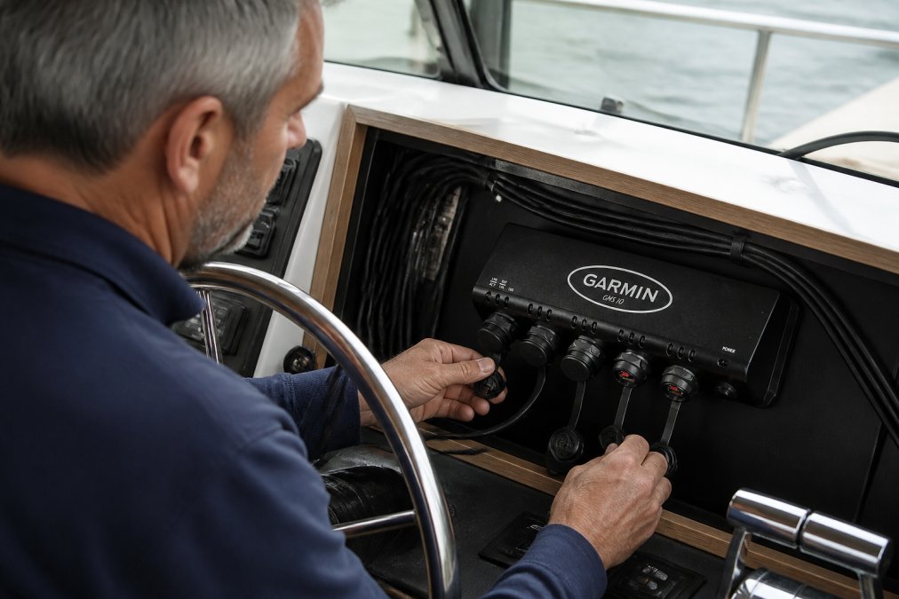
The device list confirms that all your hardware is communicating and allows you to assign data sources. For example, if you have two transducers, you can specify which one feeds sonar data to which display.
Network discovery should happen automatically. If a device doesn't appear, verify it's powered on and properly connected. Check the drop cable for damage or corrosion. Reseat the connector at both ends. If the device still doesn't appear, power cycle the primary chartplotter to force a fresh network scan.
Once all devices appear in the list, configure data sharing. Specify which transducers feed sonar data to which displays and which devices provide heading or wind data. This ensures redundancy: if one display fails, the others still have access to all sensor data.
Sharing Sonar Data Between Garmin Displays
Sonar data sharing is one of the most powerful features of a Garmin marine network. Once configured, every chartplotter displays the same sonar data from a single transducer, eliminating the need for multiple transducers.
The transducer sends sonar returns to the backbone, and every connected MFD receives and displays that data simultaneously. To enable sonar sharing, configure the primary display to accept sonar data from the transducer, then configure secondary displays to use that same sonar source through the Network or Sonar settings.
Bandwidth is a consideration. Sonar data is high-frequency and bandwidth-intensive. A single sonar stream across the network rarely causes problems on recreational boats, but very high-frequency sonar (like 1 MHz) may introduce minor latency on other network devices.
Synchronization is automatic. Because all displays receive sonar data from the same transducer, they're always in sync. You won't see one display showing a fish mark that another misses.
Troubleshooting Garmin Marine Network Connectivity Issues
Connectivity issues are usually caused by one of a few predictable problems. Systematic troubleshooting eliminates most of them quickly.
Start with the device list. If a device has disappeared, it's either powered off, disconnected, or experiencing a communication failure. Power cycle the device. If it reappears, check the connector for corrosion or the drop cable for damage. If it doesn't reappear, move to the next step.
Check physical connections. Visually inspect every connector on the backbone and every drop cable for corrosion. If you see white or green corrosion, unplug the connector, clean the pins with contact cleaner, and reseat it firmly.
Verify power. A device that's powered off won't appear on the network. Check that the device has power and that the power supply voltage is stable. If your power supply is weak (below 11V under load), upgrade it.
Inspect the backbone for damage. Physical damage to the backbone affects every device on the network. Look along the entire cable run for signs of wear.
Check termination. The backbone must have terminators at both ends. Verify that both ends have proper terminator blocks installed and seated firmly.
Reboot the primary display. Sometimes the primary chartplotter's network stack gets stuck and requires a full restart. Power cycle the primary display and wait for it to complete its startup sequence.
If connectivity issues persist, isolate the problem. Unplug all drop cables except one device, then power up. If that single device connects reliably, add devices back one at a time to identify which one is causing the issue.
Network Expansion and Cabling Best Practices
Expanding your Garmin marine network is straightforward if you plan ahead and follow best practices.
When adding a new device, you'll need a new drop cable and a T-connector to tap into the backbone. Keep the drop cable as short as practical, ideally under 15 feet. If your new device is far from the existing backbone, consider running a new backbone segment rather than a very long drop cable.
Cable routing matters. Keep network cables away from high-current power cables, engine compartments, and sources of electrical noise. Run them in separate conduits if possible. Cross power cables at right angles, not parallel, to minimize electromagnetic interference.
Use marine-grade cables and connectors throughout. The cost difference is minimal, and marine-rated connectors resist corrosion far better. Charleston Yachting carries Garmin 20' Marine Network Cable - RJ45 and Garmin 6 Ft Marine Network Cable, RJ45 specifically designed for saltwater environments.
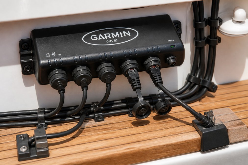
Consider a network switch or port expander if you're adding multiple devices. The Garmin GMS 10 Network Port Expander [010-00351-00] allows you to connect multiple devices without daisy-chaining them along a single backbone. For most recreational boats under 50 feet, a simple daisy-chain backbone works fine.
![Garmin GMS 10 Network Port Expander [010-00351-00]](https://cdn.shopify.com/s/files/1/0842/4914/9751/files/16019XL.jpg?v=1775841406)
Plan for future expansion. If you think you might add devices later, run extra drop cables during initial installation. This is far cheaper and easier than retrofitting later. Label all cables clearly.
Voltage drop becomes relevant on larger networks. If your backbone is more than 50 feet long or if you're running many high-power devices, measure voltage at the far end of the network. If it's dropping significantly, upgrade to thicker power cables or add a secondary power supply at the far end.
Conclusion
A properly installed Garmin marine network integrates your navigation, sonar, and sensor data into a unified system that improves safety, reduces redundancy, and simplifies troubleshooting. The installation is straightforward, cabling, connectors, grounding, and device discovery, but attention to detail matters. Corroded connectors, poor grounding, and weak power supplies cause most intermittent faults.
Charleston Yachting stocks the marine-grade cables, connectors, and network components you need to build or expand your system correctly. The [Garmin BlueNet 30 Gateway [010-02613-00]](https://charlestonyachting.com/products/garmin-bluenet-30-gateway-010-02613-00) bridges legacy Garmin devices with modern network architecture, and our selection of marine network cables, from 6-foot to 20-foot lengths, ensures you have the right length for your installation. Get started with Charleston Yachting and build a network that keeps you connected and safe on the water.
![Garmin BlueNet 30 Gateway [010-02613-00]](https://cdn.shopify.com/s/files/1/0842/4914/9751/files/101312XL.jpg?v=1775848734)
== FAQ ANSWERS (audit these too, same rules) ===
[1] Q: Is a Garmin network cable the same as Ethernet? A: No. Garmin marine network cables use RJ45 connectors like Ethernet, but they are specifically shielded and rated for marine environments. Standard Ethernet cables lack the corrosion resistance and shielding required on a boat. Use marine-grade cables like the Garmin 6 Ft Marine Network Cable, RJ45 or Garmin 20' Marine Network Cable - RJ45 to prevent signal degradation and connectivity failures in wet conditions.
[2] Q: What is the difference between NMEA 2000 and Garmin Marine Network? A: NMEA 2000 is an industry-wide standard that allows devices from different manufacturers to communicate. Garmin Marine Network is Garmin's proprietary protocol designed specifically for Garmin devices. NMEA 2000 offers greater interoperability with third-party sensors, while Garmin Marine Network provides faster data sharing between Garmin units. Many modern Garmin systems support both through gateways like the Garmin BlueNet 30 Gateway [010-02613-00].
[3] Q: Can you run two Garmin units off one transducer? A: Yes. A single sonar transducer can feed data to multiple Garmin chartplotters using the marine network. Connect the transducer to one unit, then share the sonar data across the network to other displays. This eliminates the need for multiple transducers and reduces installation complexity while allowing all crew members to view the same sonar feed simultaneously.
[4] Q: How do I troubleshoot a Garmin Marine Network connection? A: Start by checking physical connections: verify RJ45 cables are fully seated and not damaged. Confirm all devices appear in the device list on your MFD. Check for firmware updates on all connected units. Inspect cables for corrosion or salt spray damage. If devices still don't communicate, power cycle the entire network by shutting down all units for 30 seconds, then restart in sequence. Test with a shorter cable first to rule out cable length or quality issues.
Frequently Asked Questions
Is a Garmin network cable the same as Ethernet?
No. Garmin marine network cables use RJ45 connectors like Ethernet, but they are specifically shielded and rated for marine environments. Standard Ethernet cables lack the corrosion resistance and shielding required on a boat. Use marine-grade cables like the [Garmin 6 Ft Marine Network Cable, RJ45](https://charlestonyachting.com/products/garmin-6-ft-marine-network-cable-rj45-010-10550-00) or [Garmin 20' Marine Network Cable - RJ45](https://charlestonyachting.com/products/garmin-20-marine-network-cable-rj45-010-10551-00) to prevent signal degradation and connectivity failures in wet conditions.
What is the difference between NMEA 2000 and Garmin Marine Network?
NMEA 2000 is an industry-wide standard that allows devices from different manufacturers to communicate. Garmin Marine Network is Garmin's proprietary protocol designed specifically for Garmin devices. NMEA 2000 offers greater interoperability with third-party sensors, while Garmin Marine Network provides faster data sharing between Garmin units. Many modern Garmin systems support both through gateways like the [Garmin BlueNet 30 Gateway [010-02613-00]](https://charlestonyachting.com/products/garmin-bluenet-30-gateway-010-02613-00).
Can you run two Garmin units off one transducer?
Yes. A single sonar transducer can feed data to multiple Garmin chartplotters using the marine network. Connect the transducer to one unit, then share the sonar data across the network to other displays. This eliminates the need for multiple transducers and reduces installation complexity while allowing all crew members to view the same sonar feed simultaneously.
How do I troubleshoot a Garmin Marine Network connection?
Start by checking physical connections: verify RJ45 cables are fully seated and not damaged. Confirm all devices appear in the device list on your MFD. Check for firmware updates on all connected units. Inspect cables for corrosion or salt spray damage. If devices still don't communicate, power cycle the entire network by shutting down all units for 30 seconds, then restart in sequence. Test with a shorter cable first to rule out cable length or quality issues.
This article was written using GrandRanker