

5 Best Marine Navigation Apps for Coastal Cruising

Table of Contents
- Quick Comparison: Top Marine Navigation Apps at a Glance
- How We Evaluated These Marine Navigation Apps
- Marine Navigation App Features That Matter for Coastal Cruising
- Integrating Mobile Apps With Boat Electronics
- How to Use GPS Apps for Sailing: A Step-by-Step Walkthrough
- Battery Drain, Data Privacy, and Regulatory Compliance
- Garmin Hardware That Pairs With These Apps
- Frequently Asked Questions
Last Updated: September 29, 2026
Quick Comparison: Top Marine Navigation Apps at a Glance
Marine navigation apps have become essential tools for coastal cruising, turning a smartphone or tablet into a capable backup chartplotter. The best marine navigation apps for coastal cruising combine offline charts, AIS tracking, and weather routing in one package. This guide from Charleston Yachting breaks down what matters, how these apps pair with onboard hardware, and where most boaters go wrong. Reliable data management remains a critical skill for any navigator, mirroring the same principles of preparation required when using offline navigation apps to traverse unfamiliar terrain.
Below is a quick look at how the leading options stack up. Prices reflect current subscription or one-time costs, and "best for" reflects the boater most likely to get value from each.
| App | Pricing Model | Offline Charts | AIS Support | Best For |
|---|---|---|---|---|
| Navionics Boating | Subscription | Yes | Yes (with Wi-Fi AIS) | All-around coastal cruising |
| Garmin ActiveCaptain | Free + chart purchase | Yes | Yes (Garmin MFD) | Garmin hardware owners |
| Aqua Map | Subscription | Yes | Yes | Budget-conscious cruisers |
| iNavX | One-time + charts | Yes | Yes | DIY and legacy systems |
| PredictWind | Subscription | Limited | No | Weather routing focus |
What most guides miss is that the app matters less than how it talks to your boat. A cheap app paired correctly with your instruments beats a premium app running in isolation.
![Garmin quatix 8 - 47mm AMOLED Marine GPS Smartwatch [010-02904-50]](https://cdn.shopify.com/s/files/1/0842/4914/9751/files/109348XL.jpg?v=1775849831)
How We Evaluated These Marine Navigation Apps
We judged each app on five criteria that actually affect a day on the water: offline chart quality, AIS and weather integration, hardware compatibility, ease of use at the helm, and total cost over three years. Charts that fail offshore are worthless, so offline reliability carried the most weight.
A common mistake is ranking apps by feature count.
Marine Navigation App Features That Matter for Coastal Cruising
The features that separate a usable app from a frustrating one come down to charts, AIS, tide and current data, and, the part most guides skip, how much power all of it draws. Get these right and the app earns its place on your pedestal.
Offline Charts and Vector vs. Raster Formats
Offline chart availability is non-negotiable for coastal cruising. Cellular coverage drops the moment you leave the harbor, so any app that streams charts live will leave you blind when it counts.
AIS Tracking, Weather Routing, and Tide Data
AIS tracking shows nearby vessel traffic on your screen, which is invaluable in busy coastal waters and shipping lanes. Most apps receive AIS data over Wi-Fi from an onboard receiver or a compatible transponder. Class B traffic, the smaller recreational and fishing vessels, is the traffic most likely to surprise you, so confirm your app displays both Class A and Class B targets, not just commercial shipping.
Power Draw: The Feature Nobody Lists
Every feature above costs battery, and the combination is brutal. A tablet running GPS, Wi-Fi, a bright screen, and a live AIS feed can pull several watts continuously, enough to flatten a typical tablet in a few hours of daylight running. That is the single most common reason an app that worked in the slip quits a mile offshore.
A few habits keep you running:
- Dim the screen to the lowest readable brightness; the display is usually the largest single draw.
- Turn off Wi-Fi when you are not actively receiving AIS or boat data, and let the app fall back to its internal GPS.
- Keep the device out of direct sun, heat accelerates battery drain and can trigger thermal throttling.
- Carry a dedicated 12-volt USB charger or a power bank sized for a full day, not a phone-top-up.
- Close background apps; a navigation app competing with email and maps for processor time drains faster.
Integrating Mobile Apps With Boat Electronics
An app that talks to your instruments is worth ten that don't. Integration is where most boaters hit a wall, and it's also where the biggest gains hide, and where nearly every ranking guide stops short. The good news: modern apps handle this better than they did even a few years ago, and you rarely need to replace your electronics to make it work.
NMEA 2000, Bluetooth, and Wi-Fi Connections
NMEA 2000 is the backbone standard for marine electronics, and it's how your chartplotter, instruments, and autopilot share data. Apps rarely connect to NMEA 2000 directly. Instead, they bridge through a Wi-Fi gateway or a Bluetooth connection to your multifunction display.
Garmin quatix 7 Pro Marine GPS →
Working With Legacy Onboard Electronics
Older chartplotters can still join the party. Many boaters assume a fifteen-year-old display is a dead end, but a Wi-Fi gateway or a handheld that streams boat data can bridge the gap. This is the part nobody tells you about: you often don't need a new MFD to get app integration, just the right bridge device.
Before you buy anything, confirm three things:
- Which protocol your existing instruments output (0183, 2000, or both).
- Whether your chartplotter can act as a bridge or needs a separate gateway.
- Which data sentences your app actually consumes, depth, wind, heading, and GPS are the common ones, but not every app reads every sentence.
How to Use GPS Apps for Sailing: A Step-by-Step Walkthrough
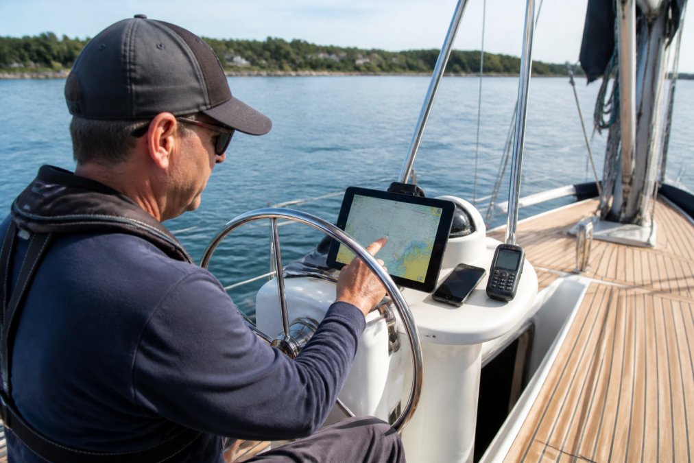
Setting up a GPS app for sailing takes about an hour if you follow a clear order. Skipping steps leads to the classic failure: an app that works in the slip and quits a mile offshore.
- Install the app and create your account before you leave the dock
- Download all charts for your cruising region while on Wi-Fi
- Connect the app to your boat's Wi-Fi gateway or Bluetooth device
- Verify GPS positioning and confirm your vessel shows correctly on the chart
- Set your waypoints and build the route for the day
- Configure an anchor alarm and depth alerts before anchoring
- Test everything in the slip, then again just outside the harbor
Battery Drain, Data Privacy, and Regulatory Compliance
Two things kill app performance on the water: power draw and forgotten settings. A tablet running charts, GPS, and Wi-Fi at full brightness will drain fast. Bring a dedicated charger or a power bank rated for marine use, and dim the screen when you can.
Garmin Hardware That Pairs With These Apps
Garmin hardware gives these apps a serious upgrade, and it's the ecosystem most coastal cruisers already run. Pairing a Garmin handheld or smartwatch with your navigation app extends control and data to your wrist and your hand.
Frequently Asked Questions
What is the best app for navigation at sea?
There is no single answer because it depends on your boat and your cruising area. The strongest setups pair a dedicated marine navigation app with hardware that supports the same chart format. Garmin's BlueChart g3 coastal charts, for example, appear on the GPSMAP 86sci handheld at $699.99 and sync with compatible Garmin chartplotters, so your waypoints and routes carry over. Match the app to the electronics already on your boat rather than chasing the highest download count.
Are marine navigation apps reliable for offshore use?
Reliability depends on whether you have offline charts and a backup power source. Apps that cache vector charts for your full cruising area work without a cell signal, but a phone or tablet is still a single point of failure. Carry a dedicated handheld like the Garmin GPSMAP 86i at $599.99, which floats, runs up to 35 hours in 10-minute tracking mode, and supports inReach satellite messaging. Redundancy, not the app alone, is what makes offshore navigation dependable.
How do I choose the right marine navigation app for my sailboat?
Start with three questions: which chart format your existing chartplotter uses, whether you need AIS tracking or just GPS positioning, and whether you want a subscription or a one-time chart purchase. If your boat runs Garmin electronics, the GPSMAP 86sci with preloaded BlueChart g3 coastal charts at $699.99 integrates directly. If you are starting fresh, pick the app first, then choose hardware that supports its chart format so you avoid paying twice.
What app is better than Navionics for coastal cruising?
Garmin's BlueChart g3 platform is worth comparing because it merges Garmin and Navionics chart data into one product. The GPSMAP 86sci at $699.99 comes preloaded with BlueChart g3 coastal charts, showing 1-foot contours for accurate bottom structure. The advantage is hardware integration: the same charts run on Garmin chartplotters and quatix smartwatches, so you are not juggling separate subscriptions across devices.
Can I use a marine navigation app without a cellular signal?
Yes, if you download charts before you leave the dock. Vector charts for a full coastal region take up far less storage than raster charts, so a phone or tablet can hold several regions. The Garmin quatix 7 Pro supports BlueChart g3 charts sold separately and runs up to 42 hours in GPS mode, giving you a wrist-based backup. Test your offline setup on a short trip before relying on it for a multi-day cruise.
Coastal cruising rewards preparation, and the gap between a smooth passage and a stressful one usually comes down to gear that works together. Charleston Yachting stocks the Garmin handhelds, quatix smartwatches, and ACR safety beacons that make these apps genuinely useful offshore, backed by same-day shipping so your upgrade arrives before your next window. Browse the full selection and get your navigation setup dialed in. Shop All